The answer to the question of which country was the first to launch an artificial satellite of the Earth is known even to every three-year student – this is the USSR. The launch date of the first artificial Earth satellite is October 4, 1957.
The first launch of an artificial satellite of the Earth became possible thanks to achievements in many branches of science and technology. With its help, for the first time, scientists measured the density of the upper layers of the atmosphere, the features of the passage of radio signals through the ionosphere, and tested many theoretical calculations and technological solutions. The photo of the first artificial satellite of the Earth has become the personification of astronautics.
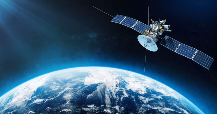
What are artificial earth satellites?
An artificial satellite of the Earth can be called an apparatus rotating in a geocentric orbit at a speed not lower than the first space one. Otherwise, it is only a rocket probe that makes measurements on the ballistic section of the trajectory and is not registered as a satellite. According to the tasks solved by artificial satellites, they can be classified into:
- applied;
- research.
Classification of satellites by activity

- A satellite on which measuring equipment is installed, flash lamps for giving light signals, radio transmitters, and so on, is called active.
- Passive satellites are needed mainly for observations from the Earth’s surface to perform a number of scientific tasks. Such satellites, for example, are giant balloon satellites with a diameter of several tens of meters.
Research satellites are designed to study our planet, any celestial bodies and outer space. This includes:
- geodetic satellites;
- geophysical satellites;
- orbital astrophysical observatories, etc.
Applied HIS include:
- meteorological satellites;
- communications satellites;
- navigation satellites;
- devices that explore the bowels of the earth;
- devices for technical purposes (investigating the impact of space on materials, working out and testing on-board systems).
The ships manned by astronauts also belong to the artificial satellites of the Earth.
Classification of satellites by orbit parameters

The movement of artificial Earth satellites can be organized in different ways:
- Satellites orbiting approximately above the equatorial line are called equatorial.
- Accordingly, satellites flying over or near the poles are called polar satellites.
- Apparatuses in a circular orbit around the equator at a distance of about 36 thousand km from sea level and moving in the direction of the Earth’s rotation turn out to be "hovering" over the same point on the planet’s surface. They are called geostationary.
Secondary orbital objects are rocket nose fairings, the last stages of upper stages and other parts that are separated during satellite launches. They are not considered satellites, although they orbit the Earth for some time and are sometimes even used as objects of observation.
The results of the space race
After the launch of the first Soviet satellite, other countries began to strive for this:
- "Explorer-1" (USA) -1958;
- "A-1" (France) – 1965;
- Vresat-1 (Australia) – 1967;
- Osumi (Japan) – 1970;
- "China-1" (PRC) – 1970;
- Prospero (Great Britain) – 1971.
Many satellites made in different countries of the world were launched using launch vehicles from the United States, and then Russian ones. A lot of launched satellites are the fruit of international cooperation.
The question of how many artificial satellites the Earth has, perhaps, no longer has an exact answer. Over the entire history of cosmonautics, more than 2,500 different satellites have been launched, many of which have long since ceased operation and have been de-orbited, and some of them are revolving around the planet as dead and dangerous cargo. In total, more than 16,000 objects revolve around our planet, of which only about 850 are functioning. Gradually, fragments of old devices slow down on the atmosphere, descend into dense layers and burn out there.
Video about artificial earth satellites
How do satellites help humanity?
For a long time, many satellites have been transmitting video in real time from continent to continent. In 2009, the Americans launched a huge seven-ton telecommunications satellite to broadcast almost all of North America.
Thanks to meteorological satellites, people get a picture of the distribution of clouds over the entire planet. This is important to know, since the dynamics of the atmosphere are as closely connected with many deserted areas as with the main habitats. The advantages of satellites include their ability to constantly observe, track the dynamics of hurricanes, they can warn of impending danger in time.
Satellites provide invaluable assistance in conducting space photography of the Earth’s surface, which is necessary for geologists and cartographers. Thanks to satellites, geologists obtained for the first time excellent photographs of vast spaces and entire continents, with their help large-scale geological structures became visible, to which deposits of certain minerals are usually tied. From space, the largest tectonic faults in the crust are perfectly visible, which go many kilometers deep into the lithospheric plates and stretch over the surface for hundreds and even thousands of kilometers. Geographers also receive a lot of important information via satellites: features of soils and topography, different types of landscapes, distribution of underground and open waters.

In pictures taken with the use of various light filters that transmit only a certain spectrum of radiation, you can see a complete and very accurate picture of natural conditions. These are the so-called spectrozonal images. It is easy to distinguish deciduous forests from coniferous ones, various agricultural crops affected by diseases or pests on them.
Satellites also help nature conservation when they monitor water or soil pollution that has spread over vast areas. Satellites track the movements of these spots, which allows you to take preventive measures.